|
SOUTH AMERICA ADVENTURE WEST
PART 6 -PERU
Desaguadero, Peru to Lima, Peru
May, 5 to May 27, 2002
Start 38,868 miles (62,691 km),
end 38,969 miles (62,843 km) cumulative
 Teasers:
 | It's 5
AM. Don't these farmers sleep |
| Islands
that really do float |
| Lightning
is attracted to these ancient funeral towers |
| On to Cuzco,
the fast way |
| So exactly
how did the Incas build their walls |
| Plaza de
Armas in Cuzco, you can have it |
| The Inca
trail, what a splendid hike |
| The best
museums in South America are in Lima |
| A visit
to the zoo, a walk along the beach, and it's back to the north |
"For my part, I travel not to
go anywhere, but to go. I travel for travel's sake. The great affair is
to move."
Robert Louis Stevenson, "Cheylard
and Luc," Travels with a Donkey (1879)
Introduction to Peru
I would suppose that of all the
countries in South America, Peru's history is the most central and common.
After all it was the center of both the Inca empire and the Viceroyalty
of Peru. However, long before the Inca there were many other advanced civilizations
both in the Altiplano and along the coast. The earliest of the great civilizations
was the Chavin emerging in the northern highlands around 950 B.C. Centered
on a location today known as Chavin de Huantar, it appears to have been
more a spread of a single religious ideology rather than a military advancement.
Following the demise of the Chavin around 450 B.C., several more localized
cultures developed including the Nazca, Gallinazo, Mochica, Paracas, and
Chimu on the coast and the Wari and Tiwanaku in the highlands. The Chimu
are particularly noted for leaving behind the enormous ruins of Chan Chan
just north of the city of Trujillo. It is supposedly one of the world's
largest mud cities. The Inca, as we've seen, came to prominence around
the 13th century and reached their apex just as the Spaniards conquerors
arrived in 1532.
I've covered the colonial period
of Bolivia in the previous newsletter. This history is essentially valid
for the entire region. So I won't repeat it here. Independence, when it
came in 1824, was more imposed upon Peru by rebellions Argentines, specifically
the army lead by San Martin, and General Bolivar from Venezuela. Bolivar
and San Martin did not get along at all. San Martin resigned his post and
took exile in France. Bolivar's general Sucre was left with the task of
completing the final military victory in Ayacucho on December 9, 1824.
For the next 2 decades political
instability was the norm. During the years from 1821 to 1845 there were
some 24 different regime changes and the constitution was rewritten six
times. It wasn't until the guano era of 1845 to 1870 that the political
environment of Peru began to stabilize.
Guano is made by the droppings of
millions of birds, in this case on the Chincha Islands. In three decades
Peru exported 12 million tons of this natural fertilizer to Europe and
North America where it stimulated the commercial agricultural revolution.
This amazing bonanza presented Peru with an outstanding opportunity for
development, an opportunity that was squandered leaving only a boom/bust
export dependence. Massive expenditures were made to expand their railroad
into some of the most difficult terrain imaginable. This along with numerous
other state enterprises caused Peru to become the world's largest borrower
on London money markets. Yet they did little to stimulate other areas of
industrial development. Add to that a couple of wars, 1859-1860 against
Ecuador and 1866 against Spain, and by 1870 Peru's economic bubble burst.
Unfortunately this collapse occurred during the presidency of Manuel Pardo
(1872-1876) the first elected civilian president since independence.
Pardo was replaced by another military
leader Mariano Ignacio Prado (1876-1879) who was surprisingly antimilitary.
So after he'd slashed the military budget leaving Peru wholly unprepared
for war, Bolivia enacted it's secret pact with Peru to defend against the
Chilean invasion which began the War of the Pacific (1879-83). Chile won
the war decisively. Yet the final agreement on land ownership was not resolved
until 1929 when a U.S. moderated pact left Tacna with Peru and Arica with
Chile.
Following the war, Peru's political
and economic environment dissolved into a period of intense civil strife.
Fortunately, a General Andres Avelina Caceres (1886-90, 18954-95) brought
the country back under control by crushing a native rebellion and entering
into a controversial economic recovery program centered around the Grace
Contract. Essentially, England would forgive Peru's loans in exchange for
the rights to operate the railroads for the next 66 years. Caceres policies
initiated a long term economic recovery that lasted well into the 1920s.
One of Peru's military coups came
in 1914 when the then president Billinghurst and the congress came to such
an impasse that Congress began impeachment proceedings. Forces under Colonel
Oscar Raimundo Benavides (1914-1915, 1933-1936, and 1936-1939) took control.
This began a long term alliance between the military and oligarchy that
would last up to the revolution of 1968. This also ended over 2 decades
of civilian rule.
Peru's W.W.I economy was a roller
coaster. It started with a recession when export markets were cut off.
Then there was spiraling inflation when markets were restored. The labor
movement gained ground during this time with violent strikes on the sugar
plantations as well as Peru's first ever general strike. There was an influx
of Mexican and Russian revolution ideology as well as increased indigenous
uprisings. All this unrest came to a head at the end of Jose de Pardo and
Barreda's (1904-1908, 1915-19) term.
The beneficiary of this turmoil
was former president Augusto B. Leguia y Salcedo (1908-12, 1919-30) running
on a platform appealing to middle and working classes. His 11 year presidency
began well with a progressive, new constitution as well as a new postwar
economic growth. However it wasn't long before he trended toward dictatorship.
Running unopposed in 1924 and 1929 assured him a continued reign. His orgy
of financial excesses came to an abrupt halt with the stock market crash
of 1929. Leguia's rule collapsed one year later.
After 1930 the military and the
forces of the left became more important. From 1930 to 1968 the military
often ruled under the authority of the oligarchy to suppress the masses
represented by the leftist parties of the Alianza Popular Revolucionaria
Americana (APRA) and Partido Socialista Peruano (PSP). Brutal suppression
of APRA uprisings lead to a virtual vendetta between them and the military
which lasted an entire generation. During the depression, Peru's economy
was one of the least effected thanks to a diversified range of exports
including cotton and industrial metals. However, it did declare a moratorium
on its $180 million U.S. debt which lead to the U.S. barring Peru from
its market for the next 30 years.
Following 1942, Haya de la Torre
moderated APRA's stance on income redistribution and other leftist leanings
in response to the changing national and international environment resulting
from W.W.II. As a result Manuel Prado y Ugarteche (1939-45) legalized APRA.
Jose Lui Bustamante y Rivero (1945-48) was elected under an alliance with
the now legal APRA. Bustamante's policy of increased state intervention
in the economy was not well-conceived or managed and could not have happened
at a worse time. When Peru's exports began to sag after the war, a surge
of inflation and labor unrest eventually destabilized the government. In
1948 the military overthrew the government and placed General Manuel Odria
(1948-50, 1950-56) in the presidency.
Odria returned the country to a
state of dictatorship with public repression of the left and free-market
orthodoxy. However, Odria sought to gain favor with the urban poor and
labor through charity and social welfare measures. Political stability
brought increased national and foreign investment and the Korean War produced
an increase in prices for Peru's exports. During this time economic expansion
brought prosperity to the coastal region while development in the Sierra
stagnated. Campesinos left the sierras in droves for possible jobs around
Lima resulting in huge slums surrounding the city. Those left in the Sierras
invaded land and held massive strikes demanding land reforms.
A reform minded junta of the military
headed by General Ricardo Perez Godoy (1962-63) took control and promptly
called for new elections which were won by Fernando Belaunde Terry (1963-68,
1980-85). Belaunde ushered in a period of reform which included agrarian
reform, colonization projects in the jungle, and construction of a longitudinal
highway fringing along the jungle. Unfortunately the agrarian reform was
not sufficient to quell the peasant revolts. In addition continuing financial
problems plagued his government. In 1968 the military under General Velasco
Alvarado overthrew the government.
Alvarado immediately implemented
a radical reform movement which included expropriating the large agroindustrial
plantations along the coast. The accompanying agrarian reforms destroyed
the power base of the old ruling oligarchy. By 1975 half of the arable
land had been transferred to various types of cooperatives. He also nationalized
much of the country's industries so that by 1968 3/4 of mining, 1/2 of
manufacturing, 2/3 of commercial banking, and 1/3 of fishing were under
state control. He reduced economic dependency on the U.S. and established
pacts with the Soviet Union and Far East.
By the end of 1975 Velasco's reforms
were running out of steam. Too much bureaucracy, mismanagement, and the
world oil embargo triggered serious inflation. Velasco became more authoritarian
and more manipulative of politics. His replacement, General Morales Bermudez,
spent most of his term implementing an austerity program to stem inflation.
Public opinion turned against military rule forcing Bermudez to move for
elections.
Belaunde was reelected in 1980.
He did an about face from the previous government by privatizing most state-run
industries. Natural calamities and a sharp decline in international commodity
prices spelled doom for his reforms. By 1983 production had fallen 12%
and wages 20% in real terms while inflation spiraled. Peru's dept soared
from $9.6 billion in 1980 to $13 billion by the end of Belaunde's term.
The economic collapse of 1980 was considered the worse economic crisis
for the century. This is when the Sendero Luminoso (SL), shining path,
came into existence.
The SL was founded in the remote
and impoverished Ayacucho department by Abimael Guzman Reynoso. It blended
ideas from Marx, Mao, and Jose Carlos Mariategui, Peru's major Marxist
theoretician. They unleashed a violent and effective campaign of terror
and subversion across the country. It spread from Ayacucho, across the
Andes and into Lima and other coastal cities. By the end of Belaunde's
term some 6,000 Peruvians had died and over $1 billion in damage had been
inflicted by both the rebels and the military forces trying to suppress
them. Additionally, Belaunde had to confront an increasing tide of drug
trafficking. Coca grown in the Huallaga Valley, 379 km from Lima, passed
through Colombian traffickers on its way to the U.S. and Europe. Belaunde,
under pressure from the U.S., sought to eradicate the plant. The SL aligned
itself with the Coca farmers making it one of the richest guerrilla movements
through collection of "taxes" in exchange for protection.
Elections were held in 1984 and
APRA candidate Alan Garcia Perez took control. His economic policies resulted
in only more poverty and social unrest. In 1990, after 2 rounds of elections,
the now infamous Alberto Fujimori took control. Fujimori dissolved congress
and suspended the constitution claiming that he needed free reign to institute
free market reforms, combat the rebels, and eliminate corruption. Elections
held in 1993 trended away from the traditional parties to a range of independent
candidates who won most of the council seats. A new constitution was drawn
up in October that, among other things, allowed for the immediate reelection
of a president. Fujimori ran and won again in 1995.
Fujimori's policies did not lead
to rapid economic progress. Rising unemployment and the austerity program
lead to hardship for many. On December 17, 1996 Tupac Amaru guerillas infiltrated
the Japanese embassy in Lima taking 490 people hostage. They demanded release
of imprisoned SL members and new policies aimed at alleviating poverty.
Negotiations continued until April 22, 1997 when crack troops assaulted
the embassy, freed the hostages, and killed all the terrorists. Fujimori
regained popularity, but still had not taken any concrete measures to improve
the economic situation. He also manipulated congress into allowing him
to run for a third term claiming that the new constitution allowing 2 consecutive
terms did not apply to his first term. As elections approached, Fujimori
stood neck to neck with a candidate of indigenous origins, Alejandro Toledo.
In May 28, 2000, Fujimori won. However,
soon thereafter he was forced from office, fleeing to Japan with a major
chunk of the Peruvian treasury, and Toledo took office. Toledo appears
to be trying to continue the privatization plans which may include selling
commercial rights to such national resources as the Machu Pichu reserve.
Originally a popular candidate with his "more jobs" campaign, public opinion
is rapidly eroding.
Around blue waters we go
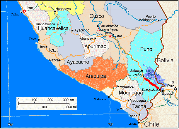
May 6, 7, 8 - Desaguadero to Puno, Peru
Well, this would be it. Our last country to visit on this journey would
be Peru. Yet we still had to get in. Everything we'd heard both in various
guide books, from other travelers, and even from the women at the hotel,
tourists really get hassled by the Peruvian border guards. Let's put it
this way, many of Peru's government employees are corrupt and not past
seeking bribes or tricking strangers into giving them money when it's not
necessary. We know of one person who was told he had to have a visa to
enter and was charged a whopping $50 US to get it. He really didn't have
to have more than the usual tourist card which is free. He was being swindled.
So the night before I spent time practicing what I would say to get that
tourist card for free.
We'd also heard all kinds of stories about betting ripped off when changing
money. It could be anywhere from rigged calculators, counterfeit bills,
or sleight of hand manipulations. With all the warnings we were really
on edge as we crossed the bridge.
The whole affair proved to be no problem. We selected one of the many
money changers sitting with little desks and calculators at the border
and began our transaction. She didn't even blink as we checked each bill
over carefully and insisted she swap ones we considered suspect. Then we
walked into immigration with passports in hand, filled out the tourist
cards, got our stamps valid for 90 days no less, and we were done. We rode
out of Desaguadero both surprised and relieved. Perhaps Peru, for us maybe,
will not live up to its disreputable reputation. We'll still be extra cautious
no matter what.
We immediately noticed a difference from Bolivia. The road that had
been new and smooth in Bolivia was now rather old and a bit broken-up in
Peru. But there were also subtle differences in the houses and vehicles
that showed that Andean Peru has a bit more wealth than Bolivia. First,
we saw several people riding motorcycles, something we never saw in Bolivia.
Also, the houses had metal roofs and were covered in stucco and painted
far more often than in Bolivia. There seemed to have been a government
effort to put latrines and water wells in everywhere. You could see the
little closet sized bright blue latrines everywhere. There were road side
advertising signs, not many, but Bolivia had none. The schools seemed more
prevalent as well as there being far more children dressed in school uniforms.
There's a government sponsored trout fishery development project proudly
advertised on signs as well as family planning clinics There does seem
to be more money in Peru, but not a lot more.
As we headed up the west side of the lake we passed innumerable small
farms all being worked by hand. Native men and women would be out in their
fields from sunup to sundown using pick, shovel, and hands to till, sow,
thin, and harvest. We just couldn't get images of 17th century farming
methods out of our minds. These folks didn't even have horses to pull plows.
Just a few donkeys were used to carry enormous bales of hay or wheat. It
was almost hard to tell if there really was some four legged creature underneath.
Each family farms just a small, irregularly shaped plot. The rest of the
land usually is left as natural grass for animal grazing. Again, in the
ever constantly appearing inefficiency, a woman, man, or child was relegated
the task of standing watch over the heard all ... day ... long. Women,
at least, seemed to divide their time between spinning yarn, watching small
kids, and watching the herd. Children seemed to find some sort of amusement,
usually tossing rocks or playing with the grass. Men just seemed to watch.
Women, multitasking as usual.
We were riding along a nice flat stretch of road that skirted along
a series of beaches next to the lake. To our right the water surface was
jagged with waves pushed ahead of the winds. On our left about a km from
the main road out on perpendicular dirt roads were a few tiny villages.
Along the shore lay blue and white wooden row boats and a few small stone
fishing huts. They all looked vacant. The spot was just too tempting. Although
it was only about 2 PM we pulled over to camp within the stone walled off
yard behind one of the fish huts. Surely no one would be coming to use
the hut this evening, we thought.
I headed off to town in search of soda, water, and yogurt. Within the
little town I discovered a small square surrounded by the usual worn looking
adobe buildings. Standing to one side were a man, woman, and little girl
having some sort of discussion. I approached and asked where they may be
a store I could buy a soda at. She responded, "Right here." She and the
other fellow were both trying to buy something. She banged on the door.
The little girl, dressed in her school uniform of navy blue skirt and white
blouse, slipped inside a different gate and yelled at some woman behind.
"She's busy." came the reply. Impatiently the woman at the door banged
again. Finally we all heard shuffling from within. A tiny girl opened the
door, looked at me with big, frightened eyes, and opened the door wide.
There was so little inside I could hardly imaging trying to put together
an evening meal with what was there. There were about 3 or 4 big bags of
pastas on the floor, plastic wrapped 2 liter soda bottles with the local
name brand, a few bags of sugar, flour, and other staples, a box of small
cookie things on the floor, and a few, very few, canned goods on the shelves.
That was about it. After waiting for the girl to measure out sugar and
bag several pieces of bread for the woman, and collect money for 3 cookies
from another girl, I finally managed to get one big bottle of soda for
a whole 2 soles, that's about $.60 US.
Back outside I was surprised to find that the square which had seemed
so deserted before suddenly was full of life. Several boys had appeared
kicking the ever present soccer ball between them. Most took time to stare
at the amazing bike that had so magically appeared in front of the store.
As I readied to leave, an old man grabbed my handle bar and proceeded to
give me the 20 questions. Where are you from? Where are you going? What
is your profession? I think finding out that I'm an aerospace engineer
was enough for him. With that he finally let go.
Back at the fish camp, Brian had moved everything into the backyard
and had made himself comfortable on top of the two logs there. We both
sat comfortably, drinking sodas and watching the waves toss about the few
boats venturing out. Soon my eyes caught sight of a man headed straight
for the cabin. "uh oh." I thought, "He'll be wanting us to move for sure."
He strolled up, held out his hand, and shook ours. He wanted to know if
we were just resting.
Ron was a nice and very curious fisherman. He clearly indicated that
we could stay in his yard for the night. It would be safe and quiet he
assured. He also invited us to stay inside the cabin. He professed it would
be even safer and quieter. We declined assuring him that our tent would
be just fine. After short discussions about travel, politics, and other
things he pulled out his paddles and a bucket of fish food from the cabin.
He rolled up his pants and headed down to the shore where his blue and
white boat awaited. It seemed to take him a good 1/2 hour to get it launched,
but soon he was bobbing away across the lake towards his trout farm.
We watched him slowly circle the trout netting while our dinner cooked.
Unfortunately he got back well before it was done. So we had to endure
his curious stares all while we ate dinner, cleaned dishes, and brushed
teeth. It was a bit of a relief when he finally signaled he had to catch
a bus for home and ran off. An audience for dinner is not something we
normally enjoy having. Early the next morning Ron was out on the lake again
and back to his cabin when he woke us with a rousing, "llevantarse." Groan.
Nice people these Aymara, but they sure are early risers.
Adventures with the locals would continue into the next night. Finding
wild campsites further along the lake became more difficult due to the
increased number of farms and villages. Also, it was impossible to get
out of sight of the road. So we finally decided to head out across one
of the fields, find a suitable spot, cook and eat dinner, and later set
up the tent just before sundown. We were soon discovered by two very curious
children. Much to our delight neither asked for money. They just asked
a lot of other questions. The girl rattled off the name of all the towns
and mountains within sight, told us about using herbs to cure coughs after
hearing Brian cough a bit, asked about the World Trade Center, and even
discussed the bad things this high altitude sun does to our too pale skin.
She was quite savvy especially considering what a remote part of the world
this. Later that evening the little boy returned with a look of concern
on his face. We'd just set up the tent. He warned, "It gets cold out here.
Did we want to go sleep someplace better." We again had to assure another
Peruvian that our tent and sleeping bags would be just fine. He looked
horrified. How could we even think of sleeping out in this cold.
In the predawn hours of 5 AM we got another rude awakening. This time
from the farmer whose field we'd camped on. Once he learned we were tourists
and that the things under the tarp were bikes, not a motorcycle, he wanted
to go through the usual series of questions. Now it's one thing to speak
Spanish when fully awake in the middle of the day. It's an entirely different
matter trying to do so just after being awoken when the mind is still murky.
He had to repeat questions 2 or 3 times before I could figure out what
he was saying. He soon went off to do whatever it was he did with his hay
field. Yet, within about 1/2 hour he was back again. He wanted to find
out what time we planned to leave. I finally convinced him we would be
going as soon as the sun came up and the ice melted off our tent. That
seemed to satisfy him. Either that or he was finished with his chores and
had decided to leave. Anyway, when we did finally get out of the tent we
looked about to discover absolutely no one else in sight. It figures we'd
have to pick a campsite right next to the hay field of the one man who
gets up at 4 AM. Enough was enough. On to a hotel where we could lock the
door and keep curious questions outside.
Floating islands and odd shaped tombs
May 9 - Puno
Puno is not an especially attractive town. Yet it's not overly ugly
either. It's just your typical poorer South American town that has just
enough tourist attractions to warrant nice hotels and restaurants. The
town was built over a former mine and has little of architectural interest.
What is most interesting is outside town, the floating islands of Uros
and the tombs of Sillustani.
The easiest way to get to these two sights proved to be by signing up
for 2 half day tours, the first to the islands and the second the tombs.
We were up bright and early once again just to grab breakfast and wait
for the van to come pick us up. We wandered around the streets of Puno
for a while, gathering people at several other hotels along the way, and
then headed down to the dock. After a short 30 minute boat ride we were
dropped off at the first of three floating islands we would visit, Isla
Totora.
We understand that the islands came into being back during the days
of the Inca empire. The Inca's were practicing genocide against the Uros,
hunting them down and exterminating them. For survival, the Uros fled into
the high reeds that cover large sections of the northern part of Lake Titicaca.
At first they kept their huts low, never exceeding the height of the surrounding
reeds. This way they kept hidden for years. Today, their houses are easily
seen from far distant and some have modern touches such as solar panels,
metal roofs, wood outer walls. They also have a wooden school house floating
on raft and a volleyball court. But just for us tourists they do keep some
of their islands in the more traditional style with just all reed huts.
The floating islands really do float. To build an island the Uros stake
out poles in the general shape of the future island. These poles will prevent
the island from moving in the currents. They then take mud and roots from
the totora reed and fill in between the poles. These roots are dense yet
do float. On top they place tied together bundles of totora reeds. On top
is placed a thick mat of loose totora. The top layers have to be changed
a lot, every month in the wet season and every 3 months in dry season.
Each island will last about 10 to 15 years. Then a new one is built and
the old abandoned. About 15 families live on each island and about 3000
people on all 45.
Totora reeds traditionally were used in almost every aspect of their
lives. Their houses, including roofs, were totora. It was used for cooking
fuel. They made boats, large and small, from the reed. Even the fleshy
white bottom of the stalk was eaten. Evidently the reed makes for clean
teeth as the children did not develop major cavity problems even after
being introduced to sugar candies. Today, however, a lot of the traditional
uses have been replaced. Wood or fiberglass boats last a whole lot longer.
Gas makes for a safer, cleaner, and easier to use fuel. The children aren't
excited about eating the stalks anymore either. But the traditional ways
do live on as a tourist attraction. As long as the money continues to float
in (pun intended), a view of the traditional Uros way of life will be retained.
Stepping onto one of these islands is a unique experience. You really
can feel it bounce, just a little. In some respects it's hard to tell if
it's really the island bouncing under your feet or if it's just the super
thick layer of totora making it seem as if it's bouncing. But, have someone
jump next to you and you really do feel the bounce. We also got to take
a ride in one of the reed boats. These boats are almost canoe like in shape
with the two gunnels made of giant rolls of reeds tied together with nylon
string. They are brought to a sharp point at one end. Often the other end
is shaped into an elaborate head of a puma or snake, traditional sacred
animals of the Andean peoples. These large boats carry 15 passengers with
a single oarsman, or woman at the back. Many small, individual boats were
also constructed and can be seen rotting away in various parts of the lake
near Puno. Each boat lasts about one year before the reeds become so waterlogged
that it wants to sink. Thus to keep enough boats running for the busy tourist
season, there are professional boat builders who are continually building
new boats.
Most of the Uros today have intermarried with the shore dwelling Aymaras
so that there are no pure Uros left. Those people who choose to live on
the islands do so because it is far easier to earn a living from tourist
dollars than from plying other trades on the mainland. The men still fish,
harvest the totora, build new boats, or run tricycle taxis in Puno. The
women sell tourist trinkets, lots and lots of tourist trinkets. They had
some beautiful needle work pieces and pottery. However, we just came away
with one small replica reed boat for our niece. That was enough.
Following a quick lunch we headed off to a site of many different ancient
tombs, Sillustani. Sillustani is located about 32 km north of Puno off
of the main highway toward Cuzco. It is a large hill that evidently is
made of magnetic ore. During lightening storms it becomes a natural lightning
attraction. I suppose the ancient people saw this behavior and came to
the conclusion that it was some magical place, touched by God. Hence the
desire to bury their dead there. Tombs cover a long expanse of time from
over 1,000 years before Christ right up to the fall of the Inca. The earliest
tombs made by the Pucara were entirely underground and, consequently, are
not visible on the hill. Later they went to a half underground, half above
form. The Tiwanaku had their tombs entirely above ground. They were circular
structures made of rough rocks piled about 10 meters high in a cylindrical
form. A small door at the bottom allowed access.
Perhaps the most interesting of the tombs were those made by the late
Tiwanaku and the Inca. These were again all above ground and usually cylindrical
in shape, although 2 rectangular ones do exist. The outside is covered
with that amazing Incan finished stone construction. More on that later.
From ground level the walls taper slowly outward coming to a lip near the
top. From there a hemispherical roof covers the top. Inside is another
pile of unfinished stones that leaves a conical shaped cavity at ground
level. It is said that the inner cone cavity is meant to represent a woman's
womb and the outer shape the man's penis. Bodies were placed inside in
the fetal position. A small door located at the bottom of the structure
always faced east to allow the morning sun to enter the chamber. The natives
believed in the after life and this entire burial arrangement was intended
to represent the womb from which the person would be reborn.
Unfortunately the archeologists found very little at the ruins. Most
had been looted by the Spaniards long before. They found a few pot shards,
arrow heads, and other trinkets and only 4 of the mummies. All riches,
if any existed, were gone. In addition, most of the tombs had been destroyed.
Tour between two cities.
May 10 - Cuzco, Peru
Time was running short. If we really wanted to hike the Inca trail,
something we'd heard was a real highlight of any South American adventure,
we would have to get to Cuzco a lot faster. Riding would take about 5 days
to a week. We simply did not have that much time So we took a bus. Not
just any bus. This was a special tourist bus that would make several stops
along the way. So even though we would not get to ride this section, we
would at least do more than whiz through it.
Several of the stops were just so-so. One was at a pottery shop in the
town of Pucara. Here they make special little bull figurines that some
folks in Cuzco use to decorate the roofs of their houses. They put up a
couple of bulls, beer bottles, flowers, cross, and other adornments right
at the peak of the roof centered on the door. It is meant to bring good
luck and is only a Cuzco tradition. We actually did spot quite a few houses
out in the countryside around Cuzco sporting this decoration. The shop
was a bit boring. It would have been nicer to have visited the actual pottery
factory.
The next stop was the pass where the bus was greeted by the usual crowd
of native women and children dressed in overly colorful costume trying
to get you to take their picture for a tip and buy assorted stuff. It seems
no matter where a tour bus stops a crowd of vendors, beggars, and picture
posers always congregate. We were more interested in learning the difference
between the alpaca and llama, samples of both were also at this stop. The
alpaca has softer fur, is smaller, and is decidedly cuter.
Lunch, provided as part of the tour, was a bizarre event. The bus wound
its way through a town that obviously was not one of your more wealthy
places. There were dirt streets, unfinished brick buildings, street vendors
with dilapidated stalls. The usual things one finds in this sort of town.
The bus wound through the streets and approached the back of one of the
nondescript buildings. A gate slowly opened. The bus backed in. We found
ourselves in a world so completely unrelated to the outside it was almost
laughable. It was clean, modern, well landscaped, colorful, and quite pleasant.
Completely unlike anything just outside the gate. We always have to wonder
how people can stand to take only these kinds of trips. They never get
to see real life. Of course there were several vendors waiting anxiously
for the bus to arrive.
The next stop was perhaps the most interesting. It was an Incan ceremonial
site called Raqchi (pronounced rak-chi). Raqchi is located at the intersection
of several of the most important Incan roads. It is on the true Inca road
that leads from Lake Titicaca to Cuzco, supposedly the route the original
Inca followed when they migrated from Lake Titicaca to Cuzco. The other
two roads intersecting at this point go down to the coast and down to the
jungle. This was a major crossroads for caravans carrying goods from each
of the ecological food zones as evidenced by the 157 large round storage
buildings located at the temple site.
But, this was not the reason this site was so important, Here was located
the most important temple to the most important God, Viricocha (the V is
pronounced like and English W). Viricocha was the God of creation. The
head honcho you might say. At the top was Viracocha. Below was a plethora
of other gods, many thousands, dedicated to everything natural you could
possibly imagine. The size of the temple speaks to the importance of this
god. It was a huge house like structure, long and rectangular with a peaked
roof. Its center wall was probably close to 30 meters in height. Twenty-two
huge stone pillars to either side of this center wall helped to hold the
roof in place. The walls were made with the usual special Incan stone for
a foundation and mud for the top, the mud was lighter and easier to extend
to these heights. The roof was supposed to have been the largest in the
entire Inca empire. We had to wonder what they had inside the temple.
On one end of the temple were several large living areas consisting
of courtyards surrounded by small rooms, called canchas. They say they
were the houses of the nobles, however the rough state of the stone walls
made you wonder. They weren't the wonderful polished, close fitted stones
normally found in the homes of the nobles. Only foundations remain of all
these buildings as most of the walls were destroyed by the Spanish. One
simply could not allow the shrine to a pagan god to stand, now could you?
Our final stop was at a town called Andahuaylillas which means "nice
place" in Quechua. It is an unusually pretty town tucked back in a little
canyon which gives it a particularly mild microclimate. Trees around the
plaza normally are found in the jungle at a much lower elevation, palms
for instance. In Inca times this town had a special use. Noble women would
come here to rest after giving birth in Cuzco. It is also the home of a
remarkable 17th century Jesuit church, known as the Sistine chapel of Peru
to the locals. Inside it has an amazing array of enormous paintings all
surrounded by ornately carved frames covered in gold leaf. The alter in
front is also covered in gold and silver giving the entire church a rather
sparkling appearance. Our guide mentioned that if you wondered where all
the gold and silver from the new world mines went, some went to Spain,
some is at the bottom of the ocean, and the rest is here. An exaggeration
perhaps, but there certainly is a lot of glittering in this particular
church.
Just as the sun was setting we finally arrived at the center of the
city of Cuzco, one of the most colonial looking cities we've ever seen.
Center of the Inca world.
May 11, 12, 13, 14 - Cuzco, Peru
Incas believed that Cuzco was the center of the world. At least it was
the center of their world. It was founded by the first Inca, Manco Capac,
sometime in the 12th century and it became the governing center of the
empire known as Tahuantinsuyo (the four corners). They divided their domain
into 4 separate regions all of which met at Cuzco. The original plan for
the city was supposed to be in the shape of a giant puma, a very sacred
animal. The puma's head was the large hill to the north on which was built
a temple to the sun known as Sacsayhuaman. The name means 'satisfied falcon'
but it is most easily pronounced almost as "sexy woman". Unfortunately
much of Sacsayhuaman was destroyed by the Spaniards following the first
Tupac Amaru rebellion. Tupac Amaru had used the hill top temple as a stronghold
and the Spaniards wanted to ensure it could never be used as such again.
The rest of the puma's body and legs were formed by streets and buildings
of the town. It's sort of a crouching puma shape, or a cat in what I call
the 'meatloaf' position.
After the arrival of the Spaniards in 1534 much of the Inca structures
were torn apart and their stones reused to build the Spanish churches and
public buildings. In many places colonial buildings now sit right atop
Inca walls creating an odd blend of indigenous and European architecture.
The Coricancha is perhaps one of the best examples of this mix. The church
of Santo Domingo was built atop one of the Inca's most important temples.
Coricancha (golden courtyard in Quechua) was the temple to the sun in addition
to having several minor temples placed within its walls. The church now
sits high atop these walls and the smaller temples have become rooms within
the church which were used by the priests as living quarters.
Coricancha was so named because when the Spaniards arrived they found
the walls completely covered with golden leaf. In addition there were gold
and silver idols placed on niches throughout the large building. In front
were a series of 5 terraces on which life sized golden representations
of agricultural life were placed; corn, animals, and other plants. It is
estimated that the Spaniards took some 2 tons of gold from this one building
alone. In our opinion it's not so much the tragedy of the loss of gold
that is so horrible. It is the loss of the artwork. The Coricancha in its
full splendor can never, ever be replaced.
During our half day city tour of Cuzco we learned about perhaps the
most incredible achievement of the Inca civilization. They were truly remarkable
engineers and architects especially in the use of stone. Pictures of their
stone walls are famous worldwide. Especially noteworthy are those where
the stones fit so tightly not even a knife can fit in the joints. Yet scientists
have as yet to figure out how they built these walls. Think about it. It
would be easy to position, shape and polish the first rock. But what about
the second lying next to it? Even more difficult how about the second row?
If the rock was small, say only 100 lbs or so, they could easily use trial
and error. Polish a little, try a fit, then polish a bit more. But what
about those rocks that weigh tons, not just pounds. There are many of them
and they're not just rectangular or blocky in shape. Often they have many
corners and sometimes even curved edges. There is no way you could use
trial and error to get an exact fit for a rock weighing that much. Some
say they may have used bamboo to get the shape. They built a bamboo outline
of the desired result then polished and cut to match. Yet still that couldn't
account for getting the small radii correct. So how did they do it? We
may never know.
Beyond the shear technical challenge of making and placing the rocks
are the interesting techniques used by their engineers for earthquake proofing.
They had a couple of techniques, all well thought out and all very successful.
One method uses a "key stone" approach. Picture a cube shaped block of
stone. In the middle of the sides that abut against other rocks is placed
a square or round shaped notch several inches deep. The adjacent rock would
have a similarly placed notch. When placed together this would form a cavity
between the two rocks. Now this cavity is filled with a third, smaller
rock. It acts as a link tying the two larger rocks together. One cannot
slide relative to the other due to this key stone. To allow some movement
between the rocks and prevent the rocks from breaking, a gap around the
key stone was often filled with precious metal, such as gold. This gave
the entire structure a bit of give.
Another earthquake innovation came from the shape of the rocks themselves.
Some buildings have nice, rectangular shaped rocks lined in neat rows.
These use the key stone method. Other walls have irregularly shaped rocks
that seem to be almost unorganized. Yet if you look closely you will notice
that every so often there is one particular rock having a lot of step shaped
corners. Stones on the rows above and below were all shaped such that they'd
wedge into these steps. Thus this oddly shaped stone would prevent the
upper and lower stones from sliding too far side to side. In addition,
along these walls would be placed occasional gaps between the stones. Again
this was to allow some movement and prevent the rocks from breaking, which
they haven't.
In addition to these earthquake preparations on the individual stone
level, the overall architecture is designed for earthquakes. Below ground
level the rocks sit on a foundation of small, round stones. This allows
the earth to move under the wall, a feat accomplished today with large
Teflon pads. The walls were built trapezoidal in cross section, thick at
the bottom. Then large rocks were placed near the bottom, smaller ones
on the top. All in all the entire design was extremely clever and considering
how long these walls have stood, very successful. I am sure today's architects
have learned a thing or two from these long gone engineers.
Once the Spaniards moved in, the character of the city was completely
altered. Spanish churches and buildings were built right atop the more
durable Inca walls. Many of these colonial structures have been rebuilt
over and over as they are continually knocked down by earthquakes. At least
their Inca foundations remain firm.
The Spaniards created three main plazas within Cuzco all of which today
are surrounded by original and well restored colonial buildings. We found
the extensive use of the Ottoman empire style porch throughout Cuzco to
be quite surprising especially around the plazas. The Plaza de Armas has
become the main tourist area. It is virtually impossible for a gringo to
stroll around or across the plaza without getting pestered by at least
5 boys selling postcards, 6 people hawking restaurants, 2 girls selling
watercolors, 3 shoeshine boys, 4 women dressed in costume wanting their
picture taken, and 2 to 3 beggars shoving hats at your shins or whining
by your side for 5 minutes. We found the Plaza de Armas to be a very uncomfortable
place to spend any time.
Four blocks away is the Plaza San Francisco, so named for the church
that faces it. This is the plaza where the locals hang out. There are no
hawkers, no sales people, no beggars. However, this seems to also be the
local toilet spot for those who have no where else to go. The strong smell
of urine is everywhere.
Our favorite plaza, Plaza Regocijo, was located right between Plaza
de Armas and Plaza San Francisco. This nicely landscaped and maintained
plaza is surrounded by highly upscale restaurants and hotels. It is not
a local hangout and also not a gringoville. It's quiet. It was the best
place for escaping the constant tourist push of Plaza de Armas. We found
ourselves returning to this plaza again and again to relax among the tall
trees.
Our stay in Cuzco extended longer than expected as we needed to make
arrangements to hike the Inca trail. In the last decade or so the popularity
of the Inca trail has forced the Peruvian government to take some drastic
measures. Strict restrictions have been placed on the number of people
allowed on the trail, only licensed tour groups can operate on it, individuals
can go only if they hire a private guide, and campsites have been restricted.
This resulted in enormous fee increases and a 2 to 5 day wait to get a
spot. In fact, some of the better known tour groups are completely booked
way ahead for the summer busy season. There has been clean-up and maintenance
along the trail as well as improved toilet facilities in some areas. But
probably it's just the government getting more money out of this extremely
popular tourist destination. In any event, it took us two days to get ourselves
signed up for a group leaving on the Wednesday after the general strike.
Tuesday groups were cancelled due to the strike. With that done we spent
our remaining days taking the city tour and seeing as many of the museums
as we could squeeze in.
Footsteps of the chasqui, Inca runners
May 15, 16, 17, 18 - The Inca Trail
Four O'clock in the morning the bus came round to pick us up. Why four?
Well, there is construction out on the road near the start of the trail
and they close the road completely at 7 AM. Otherwise we would have been
leaving at more like 9 AM. So in the black of the early morning we sat
on this bus as it wound around the streets going from hotel to hotel seemingly
turning back on itself over and over again until all 15 hikers were aboard.
Then a stop at the train station, another to get food, another to pick
up the cook, and we were finally on our way.
But not so fast. Once over the hill we made a short stop at the town
of Urubamba to pick up the porters. What a madhouse. Men wait in the early
morning for buses headed to the trail to stop. They push and shove trying
to be the ones selected for this particular group. It's quite a competition.
Some were old friends of our cook and were picked for that reason. Others
got lucky. Some, those who appeared too young or too frail, were turned
away. The new rules state that the porters get paid 60 soles, about $20,
for the 4 days hiking, only have to carry 20 kg, and get food and sleeping
arrangements included. In addition they get tips at the end. So for a Peruvian
peasant, the pay is pretty good and the work a lot easier than it used
to be. Hence the fierce competition. Once our porters were settled we had
one more stop for bread and then we were finally ready for the hike
It was about 8 AM when we arrived at km 82, a distance along the railway,
and the start of the trail. But first breakfast. Small seats, tables, table
cloths, cups for tea, and plates were brought out and distributed. Then
bread, jelly, and fruit passed around. It felt so strange. Here was this
hoard of porters, 14 in all, waiting on this group of 15 gringos. A little
too much for our simpler tastes.
The Inca trail as we know it today is actually only a small section
of the over 5,000 km trail network created by the Incas and their predecessors.
The Inca, like the Romans of Europe, figured out quite early that the key
to successful control was through a well developed communications network.
In this case it was trails and roads used for walking or for llama caravans.
They maintained 4 major trails going to the 4 administrative regions of
their realm stretching from Quito to central Chile. Offshoots from these
4 major trails were numerous essentially linking every city and town under
Inca domination to the 4 major trails. The route between Cuzco and Machu
Pichu was one of these offshoots that basically had no other purpose than
to take travelers between the two cities. The section hiked by most tourists
today is only about 32 km in length of which about 70% is the original
rock paved trail. It has been refurbished and restored as needed to accommodate
the high tourist traffic of today.
We finally seemed to get going on our first day hike at about 10 AM.
Oh well, we didn't have too far to go. After all normally they'd leave
Cuzco at a much later time than 5 AM. The first day hike was only about
4 hours with a long stop overlooking the ruins of Patallacta, or Llactapata
it can be both ways. The majority of the names of ruins are not original
Incan. These were lost in the shadows of time. Most names were invented
by Hiram Bingham with help from the locals. Although, Patallacta they think
may have been original. It is supposed to mean one atop another, to indicate
the character of the town of houses up top and terraces below, which is
why the name can be both ways. It was a tampu, later changed to tambo by
the Spaniards. A tampu was a way station along the trail where food, clothing,
and shelter could be given to the travelers. It had stone walled houses,
lots of terraces for food, and a circular temple off to one side. This
was a fairly typical tampu for that time.
It wasn't too much later that we stopped for lunch. Now here was where
the full impact of this strange guided, portered, supported hike came to
roost. By the time we reached the lunch spot the porters had long since
arrived, set up a large eating tent, chairs, and table as well as a place
for cooking. We just kind of lounged around while the cook and porters
got lunch ready and then served it up on plates around the table. This
was a far, far cry from our normal do-it-yourself backpacking. Once the
long, and I do mean very long, lunch was over we again lounged around while
the porters packed everything up and headed off. We had to admire the stamina
and resourcefulness of those porters. With not much more than a small,
ragged blanket and a reinforced plastic potato sack they were able to put
together a reasonable backpack. It even looked halfway comfortable. As
we hiked along, with the hundreds of other hikers, we were continually
passed by porters rushing to get to the next lunch or campsite. Brian commented
that he felt a little like Livingston out on a jungle safari back in the
days when you had porters carry everything imaginable. It was certainly
not a solitary experience.
The first campsite was at a town called Wayllabamba. Keep in mind that
by "town" I mean just some scattered adobe walled and thatch covered houses
along the trail. There are no roads to this place. Townsfolk have become
rather resourceful, taking advantage of the tourist trade. They set up
their backyards as campsites providing flat tent sites, a covered eating
area, and a woefully disgusting latrine. They even sell stuff; drinks,
snacks, and the very popular snickers bars. Prices are extremely high.
Yet many of our group chose to indulge.
The second day involves the climb over the worst of the 3 passes to
be surmounted. It's called Warmiwanusca, dead woman's pass, and is at a
staggering elevation of over 4200 m. Since we started the day at only about
3300 m this meant that essentially the majority of the day was spent climbing
up this incredibly steep hill. Even with 3 weeks at elevation under our
belts we were still huffing and puffing. The poor Canadian woman in our
group really had trouble as she'd been sick the night before. We did not
envy her one bit. Once there, most of our group seemed to want to leave
the pass as quickly as possible. But, as we soon learned, most of our group
seemed to have little appreciation of the entire trek. We, however, stayed
up until the last possible minute knowing we still had about 1 1/2 hours
hike to get to the campsite. The scenery was absolutely stunning.
Our campsite for the night, along with the hundreds others, was just
under the site of the Runkurakay ruins. This small, semicircular set of
buildings was a check point along the trail. It's strategic location permitted
excellent surveillance of the trail going both directions. It would have
housed mostly military or other government officials who kept track of
who went where along the trail. The Inca civilization was not a free society
and people were not permitted to move from one place to another without
proper authorization. This small station would have had food supplied from
other locations as there were no terraces for agriculture. From here it
was only another short but very steep climb up to the second pass.
By this time we were getting over to the wetter side of the mountains
and, consequently, the rain that pelted down on us for the second half
of the third day was not a surprise. At one point, during the worst of
the storm, we found ourselves bunched with about 30 others under a small
rock overhang. You couldn't move even if you wanted. Fortunately the rain
stopped in plenty of time for us to visit the spectacular ruins of Sayacmarca
and Rumiwasi.
Sayacmarca was another, smaller tampu. It had a central temple around
a sacred rock, several cancha which are rooms laid out in a square pattern
around a central courtyard, and some terraces. Rumiwasi was mainly a temple
that either was never finished or was essentially an open platform. Rumiwasi
has 6 nicely formed fountains, the upper still in use by the porters today.
Both sets of ruins were absolutely spectacular.
From here the trail becomes an amazing engineering feat. The builders
built the trail up along the edge of cliffs by piling up rocks to form
an outer wall and then filling in the middle to get the platform for the
trail. In someplaces this built-up trail was well over 10 ft high. Oh was
it steep. In some spots the trail's steps seemed to go just straight down.
Hiking was a bit treacherous. You had to take things real easy. I couldn't
imagine being one of the Inca runners who had to race along this trail
to meet their obligation. The plant life surrounding the trail was dense
jungle complete with dripping wet vines and small orchids. The rain helped
to give all an eerie feeling.
Our last campsite overlooked the ruins of Winaywayna, meaning eternally
young or eternal youth. To get to the campsite you could take the shorter,
direct route, a new, nonInca trail, or you could continue on the Inca trail
to wander through some Inca agricultural terraces. We were the only ones
of our group who chose to continue. We continued to be amazed by the miracles
in stone these Inca managed to create. The walls of these terraces stand
at least 8 ft high in most places. Steep stairs run up and down through
the terraces in many locations and our trail rambled down some of them.
It is clear they took a huge amount of effort and resources to create these
terraces. Yet the amount of land gained seems so small. It hardly seemed
worth the effort. I suppose they had no other choice. We scrambled over
the last 1/2 km of the trail in near total darkness rushing to get to camp
before we couldn't see a thing. Should have brought a flash light.
Campsite Winaywayna also happens to have a restaurant/bar at which many
of the gringos spent the evening visiting. We discovered that many of our
own group chose to hit the bar rather than see the last set of ruins. Again,
it seemed to us that some of them just did the trail to put a notch on
their belts. It's a "been there, done that" mentality. They really didn't
seem all that interested in the ruins themselves. This point became even
more evident when that evening one of the Germans was demanding to know
why he couldn't take an earlier train back to Cuzco the next day. We were
stunned. Here he'd come all this way, spent all this money, and trekked
all this distance over the previous days to get to the site of the most
famous ruins in all South America and he seemed like he couldn't wait to
leave. We' on the other hand, were wondering why we had to head down to
Aguas Calientes so early. Well, I guess it depends on what you're there
for. We wanted the really explore the sites. These folks seemed to just
want to party.
We were awakened at the wee hour of 3:30 AM for our last day of hike
and our final arrival at Machu Pichu. Unfortunately with our horrendously
slow group, we didn't get going until about 4 and did not make it to Intipunku,
the sun gate, until just after sun rise. Oh well, as it turned out the
clouds were such that there really wasn't a spectacular sunrise anyway.
Fortunately the day did improve. Intipunku was another check point along
the trail and the main gate before the royal city of Machu Pichu. It is
situated in a small saddle of Machu Pichu mountain overlooking the ruins.
It is positioned so that you see absolutely nothing of Machu Pichu itself
until you walk through the building and come out the doors on the opposite
side. Then there it is. These fabulous ruins splayed across the mountain
ridge just below. It is wondrous.
There have been a lot of theories about Machu Pichu and why it was created.
One was that it was unknown to the Spaniards. In fact, recent evidence
suggests that the Spaniards were collecting tribute from landowners in
this region. So they actually did know it existed. They never had much
interest in occupying or destroying it because it isn't really a good place
for food growth and production. It is positioned high on a steep ridge
and has virtually vertical cliffs extending down to the Urubamba river
on 3 sides. It is thought that it may have been royal retreat created by
Altahualpa's grandfather based upon the number and size of the buildings
having the fine, polished stonework normally reserved for royalty. The
Inca ruler practiced polygamy in a big way. So his family and retinue were
extremely large. Machu Pichu and the surrounding terraced fields were supposedly
large enough to house and feed about 500 to 800 people, not much more.
Most of these would have been part time visitors, the royal family. It
was started in Pachacuti's time and never really finished.
Our guide gave us a 1 1/2 hour mostly useless tour of the ruins making
some statements that proved to be contrary to what was stated in our guide
book. Fortunately we had the rest of the day to ourselves. We spent hours
and hours working our way around the ruins to some of the more out-of-the-way
spots following the guidance of our book written by some archaeologists
who'd worked on the site. The book pointed out things one would never have
seen if just wandering alone, such as a carefully worked rain gutter carved
into one of the insitu rocks under a roof overhang a clear testimony to
their water handling capabilities. It was absolutely fascinating. We could
have spent another day or half day with further investigations. But, regretfully,
we had to head down the hill to meet the train.
The trail down from Machu Pichu takes a good hour and is a knee jerking
steep zigzag the entire way. We were really shown up by a couple of boys
dressed in a mimic version of Inca costume. They were so funny. They'd
run down the trail to where it crossed the road, wait for one of the buses
to cross, give it a good yell, then run to the next road crossing usually
in time to meet that same bus. It was a game for them and clearly they
were very good at it.
Aguas Calientes is a town that has become nothing but tourist ville.
That's all it is. It has many hotels, restaurants, and trinket shops. It's
days of being a quiet native village a are long gone. I suppose the tourists
like it and the natives make good money. But we find this kind of place
sets our teeth on edge. Our one hour wait for the train was more than enough.
We arrived back at Cuzco at the late hour of 10 PM, tired and ready to
head on to Lima. Enough of overly touristy Cuzco. It's a town we probably
will be unlikely to visit again any time soon.
Last stop, Lima
May 21, 22, 23, 24, 25, 26 - Lima, Peru
We had arrived in Lima a couple of days early with the idea of taking
a bus up to Trujillo to see the Chan Chan ruins. As fate would have it,
I arrived in South America 6 months earlier with a whopping head cold and
I would now leave with another whopping head cold. I simply did not feel
any desire or umph for taking an 8 hour bus ride anywhere. In fact, it
was even difficult to make it through a whole day visiting museums. But
visit we did.
The best museums we'd found in all South America are in Lima. In particular,
the Museo de la Nacion is a huge 3 story building with an extremely well
arranged display of artifacts on all cultures of Peru chronologically ordered
from earliest to the Inca. Best of all, most of the placards are in English.
We spent an entire day in this one museum alone. Other museums contain
more artifacts and art from preColumbian as well as colonial times. But
this one museum was our favorite.
Once we got tired of museums we headed for the zoo. There we got to
see a small smattering of the bird and animal life that can be found in
the 3 regions of Peru; coastal, mountains, and jungle. It was here we got
to see the small Andean speckled bear, something you're highly unlikely
to see in the wild. It's not a bad zoo. Many of the enclosures seem fairly
reasonable. I just found seeing the large cats in the small cages a bit
too difficult. They really should have more space. The zoo made for a great,
wind-down afternoon in preparation for our flight back.
Other than museums and the zoo we found little else in Lima of great
attraction. Lima, for the most part, is an ugly city that has grown up
in leaps and bounds as campesinos head for the city to find jobs. They
usually find themselves in ramshackle slums barely eking out a living.
Even the oldest part of the city near the central plaza lacks much charm.
Most of the colonial structure were destroyed by various earthquakes and
Lima seems not to have benefited much by the 18th century splendor that
reached Buenos Aires or even La Paz. Apart from those museums, Lima just
isn't a real destination city for the tourist.
For our last evening we took a long stroll along the coast in the wealthier
districts of the city. That was enough. We'd had enough playing tourist.
It was time to get back to the camper and back to wilderness living. Ta
ta city life.
Appendix A - Route
Peru
May 6 - 49.62 km to Km 100
May 7 - 73.7 km to km 27
May 8 - 28.45 km to Puno
Appendix B - Campsites or hotels
Peru
May 6 - Shores of Lake Titcaca, Km 100
May 7 - field beside road, km 27
May 8, 9 - Hotel Imperial, Puno
May 10 - Hostal Los Ninos, Cuzco
May 11, 12 - Hostal Richary, Cuzco
May 13, 14 - Hostal Los Ninos, Cuzco
May 15, 16, 17 - Inca Trail campsites
May 18, 19 - Hostal Los Ninos, Cuzco
May 20 - 26 - Hostal Victor, Lima |